
Los Angeles Creek Freaks meet the Miracle Mile Democratic Club
April 23, 2024 § 7 Comments
LA Creek Freaks will be presenting over Zoom at the May meeting of the Miracle Mile Democratic Club (MMDC) May 1 at 7pm. This is a free and online only event, and you don’t have to be MMDC member to attend.
We’re so excited to share with you a program we’ve shaped in conversation with Mark Edwards, Amy Goldenberg, and Tracy Cook:
“The Miracle Mile Democratic Club is hosting a panel discussion on the history of Los Angeles water and underground streams. As we wrap up this winter of atmospheric rivers where curbs flooded and streets turned into rivers, we ponder with experts about the ground below us, which is comprised of existing streams, sandy washes, historic wetlands, ponds, storm drains, concrete channels and hidden creeks that have either been buried or drained. There are questions to explore such as where is the swamp land in the namesake La Cienega? What happens to a creek in the hills when it crosses Hollywood Blvd? What would Los Angeles look like if we ‘daylighted’ our creeks. Join us as Jessica Hall, Josh Link and Jane Tsong weave the mysterious narrative that is our Los Angeles water and hidden streams.”
Register at https://www.miraclemiledemocrats.org/
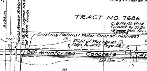
When Sacatela Storm Drain No. 3 was thought of as an improvement
September 9, 2023 § 2 Comments
Thank you to Tom McMahon for sharing this history of Sacatela Creek found in Stanford’s Barry Lawrence Ruderman Map Collection. The accompanying article and photos shows how the filling in of this land enabled dense development to occur in low lying Koreatown and Rampart Village.

I added some color to the map in the article to make the shape of the waterway easier to read.
When I read sources from early and mid 1900s, it always strikes me how clearly those who live in the LA Basin understood the direct relationship between development and flooding. It seemed to be an ordinary observation that building pavement and houses over open land changes innocent winter rains into a raging flood waters. When rains fall onto vegetated landscapes, some water is absorbed into the soil, and any movement of water over the landscape is slowed by vegetation and the terrain itself. The water that soaks into the soil moves slowly underground, making its way toward the aquifer or to daylight itself in a local water body, whether that is a stream, river, or marshy area. Removing native vegetation to cover land with paving causes rainwater to so much more quickly over urban landscapes. In a developed landscape dominated by concrete and asphalt surfaces, it doesn’t take much rain to suddenly transform sleepy streams into menacing flood waters. Unfortunately for us, the consensus solution in the early 1900s, was to fix the problem by routing streams into underground pipes.

When I read the above statement I am struck that there could have been a very different solution proposed. I keep wishing the statement had a different ending, such as: “Every street paved and every house built increases water run-off which in turn increases hazard. So let’s increase the value of the entire district by limiting further paving, and replanting our undeveloped lands with native vegetation.”
It doesn’t seem outlandish that someone might have proposed such a solution. After all, this is the same generation that pressured the federal government to protect the Angeles National Forest as our first national forest. Activists sought to protect our watershed resources by preventing the logging and grazing which devegetate the landscape, which they observed decreases local water supply in the San Gabriel Valley.
A petition to protect the San Gabriel watershed by protecting the mountains states, “Water, will be preserved in the mountains, the snow water saved as it melted, the waters protected from pollution by the large droves of cattle and sheep, disastrous floods will be prevented in winter, and the valleys below furnished with water in the irrigation season.” Note that the protection of the mountains was seen as directly connected to the reliability of water supply in the basin below.
The deep understanding of a causal effect between deforestation/paving and reduction of local water supply is lacking from much of the current conversation about water supply in the Los Angeles basin. I continue to be amazed that importing/purchasing water from ecosystems hundreds of miles away to ‘bank’ in our dams and aquifers is still taken for granted as the default solution to increasing local water supply. It is as if making a connection between our local water supply and increasing the amount of water that soaks into the ground on vegetated land is, as they say, ‘rocket science.’ This is water cycle 101, what they teach in elementary school with diagrams. Yet Southern California seems to separate this academic knowledge from practical application in managing our own local water supply.
As a general principle, increasing the amount of water that soaks into the ground beneath vegetated landscapes also reduces the degree and severity of flooding, while replenishing the moisture in the ground that supplies perennial streams with water throughout the year, and replenishing aquifers.
Returning to the topic of Sacatela Storm Drain No. 3, the vivid descriptions in the article that argue for the “vital necessity” of building the storm drain, also happen to offer an intriguing picture of the pre-stormdrain landscape, full of undevelopable land: “an area chopped up with ravines, sloughs and valleys.” At this juncture in history, if only someone had suggested to levy a special assessment district to purchase those lands to revegetate as a green/blue belt for public benefit!
At the same time the pictures of the gullies (‘arroyos’) in the article show that the stream degradation was already advanced, in a landscape that had already largely been denuded of vegetation. The surrounding development introduced large areas of impermeable surfaces to the landscape, which means that the erosive power of flood waters would be concentrated on these remaining undeveloped low lands. Gullies deepened into hazardous ravines. One could say that even before the entire waterway was encased in concrete, Sacatela Creek’s watershed had already been severely compromised, and the stream bed itself had already been reduced to the function of a storm drain. It will be our generation’s challenge to see how to balance the fact that we enjoy living in a dense city, with whether we are willing to devote resources toward restoring parts of our local water cycle so that we can all benefit from reliable local water supply, as well as healthy waterways. The water cycle is simple. The solution certainly should not have to be seen as rocket science.
Listen to local water
August 25, 2023 § 5 Comments
Listen to local water.
Whether a trickle or a torrent, whether flowing through an open streambed or confined in concrete pipe, the sound of water is an expression of the same dynamic forces that create the sinuous shape of rivers big and small, or the carving of great canyons over millennia.
During the months of August, September, and October, 2023, underflowla.net will present the sounds of water flowing under different parts Los Angeles. These waters are what remain of the tributaries that once supplied water to our great regional waterways, of which the Los Angeles River is one. And they still flow all day and all night, as does our local river, the LA River.
I notice that it has become ordinary to enjoy the sound of water fountains that circulate tap water we import from rivers hundreds of miles away, or listen to recordings of water in exotic far away places to seek respite from the stresses of urban life. During September and October, tune into local streams that flow beneath our feet instead. Listen to local water!
This project is part of Sound Under City by Jane Tsong for Our River, at Shatto Gallery in Koreatown, August 14- Sept 30, 2023
THE NORTH BRANCH: Flowing under Highland Park all day all night
Wednesdays, Saturdays, and Sundays
Live Stream Saturday August 26, 11am-12pm
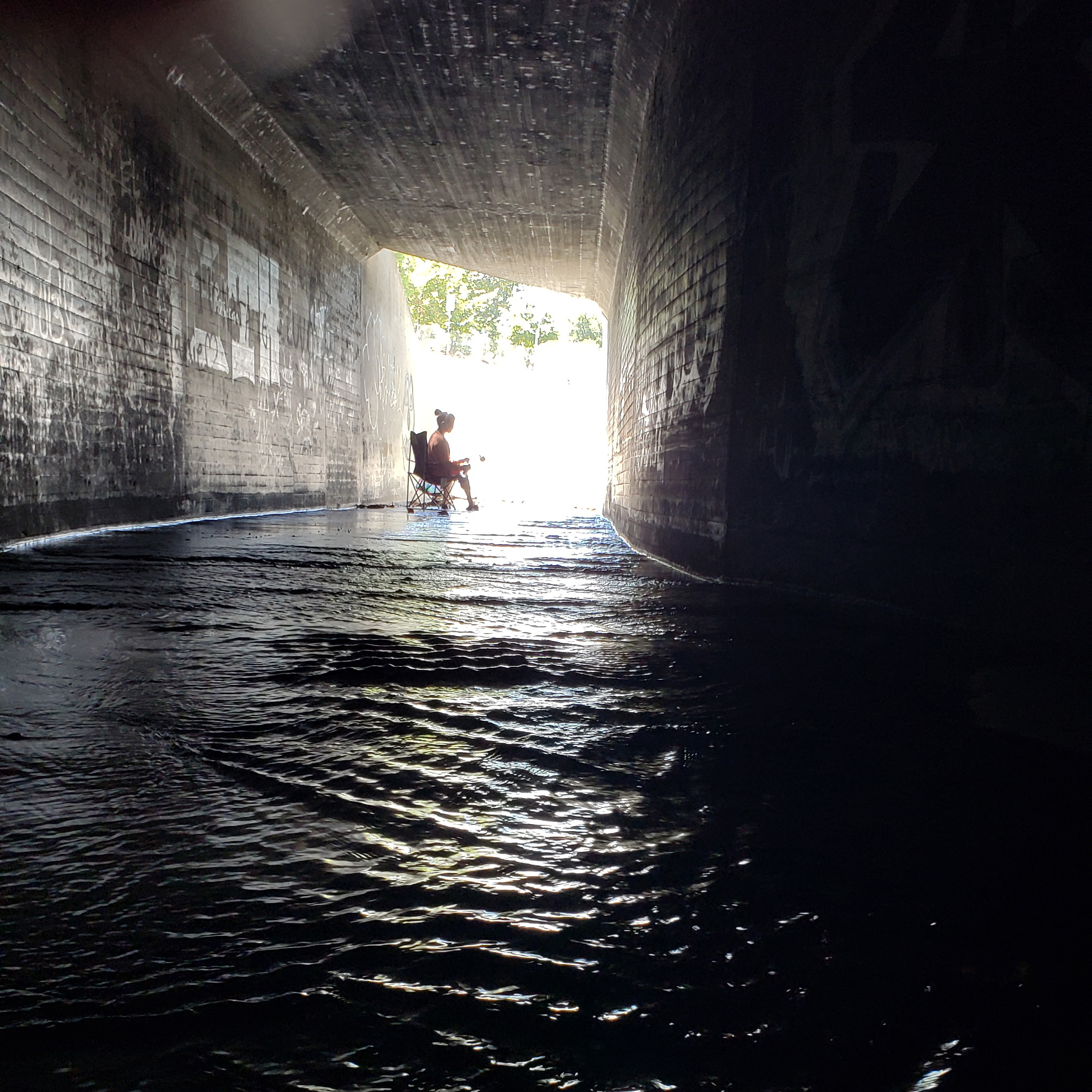
SACATELA CREEK: Sounds from underneath Silverlake, Echo Park, and Koreatown
Tuesdays and Fridays all the time
Live Stream Sunday September 3, 11am-12pm
NICHOLS CANYON CREEK: The sound that disappears under Hollywood Boulevard.
Mondays and Thursdays all the time
Live Stream Saturday September 9, 11am-12pm
Exactly as we are, the LA River
July 29, 2023 § 6 Comments
So many people are now talking about the LA River. It was not the case so many years ago, when Joe Linton and Jessica Hall founded this blog.
Recently, I was invited to write a statement for a group show at an art gallery in Koreatown that will be about the LA River. My favorite part about shows is when you have a chance to explore ideas and develop a new work alongside others in a creative conversation. The artists are a pretty diverse bunch, and there are numerous Koreans in the group. Several of the artists speak in such glowing terms about witnessing the cultural change set in motion by river rehabilitation in Seoul. They understand in a very deep way how a river can be a part of the life in a great city. And the reason we come together is in the hope something great can happen in Los Angeles. Yet in the course of these conversations, it became clear that not everyone sees our own Los Angeles River as inherently beautiful in its current state. So when I started writing the statement, I tried to acknowledge the different perspectives on beauty that came up in conversation. The gallery ended up not using the entire statement I drafted, but I share it below.
The Los Angeles River is exactly who we are as a city. It embodies our identity and history as Angelenos. Even if you don’t know of it, it already knows you, because it is formed of the discards from your life. It is a place where traces of all of us in this great city intermingle, even if you haven’t been there in person or even set foot in it.
Its headwaters are as much the local mountains as every single street, yard and parking lot in the basin. Rains wash equally over our corner of the city, collecting traces of our bodies, souls and lives, wetting our hair as well as plants animals cars and streets, it lingers, it trickles, collects, changing forms as it seeks the path of least resistance. It is detained by lawns and thirsty plants, it flows over the rooves of buildings, it stores the mineral imprint of every surface it has flowed over. What doesn’t sink deep underground collects in puddles and rivulets which coalesce into streams which join into a vast network of underground drains which lead to the great concrete conduit of the Los Angeles River. Added to local water in the river channel is a vast volume of treated municipal wastewater which we originally imported from watersheds hundreds of miles away, to be used just once and then discarded or excreted. The straightened concrete channel of the LA River facilitates the race of everything we want to forget away from us and into the sea.
Our river water is a living archive of our urban lives, and is never the same twice.
To make work about our river is to try to understand its complex beauty. This show grapples with the tension between our cultural romance of rivers (the untrammeled freeflowing rivers of our dreams) and acceptance of the river which is in front of us, made from all the parts of our lives one might rather choose to ignore.
For hungry migratory birds, the sediments collecting in the bottom of the concrete river channel substitute for riparian habitat and coastal wetlands which existed here a century ago. Like us, the birds have never experienced Southern California’s original landscapes firsthand. Yet the memory of disappeared landscapes persists in their behavior, even while they seek nourishment in the concrete channel that lies here instead.
Do we live with our river, or seek to remake it? What we cannot do is ignore our river.
Is it a pure coincidence…
May 2, 2023 § 3 Comments

Is it a pure coincidence that when you map the storm drains in Los Angeles County, showing the large diameter drains in thicker lines, that it resembles a river system? This image shows some of the 500+ miles of open channel storm drains, and 2,800+ miles of underground storm drains in the County.
One Billion Dollars
February 17, 2023 § 6 Comments
One billion dollars distracted me big time today. Well that was yesterday now. And yes, this is about water and ultimately, our creeks and rivers.
Let that be a this-is-a-long-post alert.
One billion is a huge number! It’s 1,314 homes at LA’s median selling price at this minute. It’s 6,973 median-priced hotel rooms (purchased, not rented). It’s 80-100 acres of land zoned manufacturing or industrial in the Valley. Porous, highly infiltratable to groundwater, land.
But yesterday it was reported by LA Waterkeeper that $1 billion of your LA County Measure W tax funds have, over the past 3 years, yielded:
- 30 acres of land unpaved (confusingly, they also noted that there was paving added, for a trail – ok – and also a basin liner – ? – yielding a net depaving of about 2.8 acres)
- the potential to capture 394 million gallons of rainfall runoff (which is about 1,209 acre-feet) if it rained all day (which it rarely does)
- 4,280 trees
For $1 billion.
What would I expect that to cost?
- the cost to plant a tree is about $210 (per Caltrans, 2023)
- Unpaving, if it is targeted as rain gardens, would cost about $40-50/SF – and a lot less if it is just “unpaving”.
Well that adds up to $66,238,800 for “unpaving/rain gardens” 30 acres and 4,280 trees, or about 6% of that one billion. If you look at how much water the rain gardens could have captured you’d have needed about 65 acres total for equivalent runoff capture. And that would be $143,000,000.
So if you really took a real “nature-based” approach to managing stormwater (which should maybe just be called a watershed approach – there’s a reason that jargon fell out of the water world lexicon), I’d be expecting about $857,531,200 leftover, for equivalency.
Eight hundred fifty seven million five hundred thirty one thousand two hundred dollars.
So a clue to where all that other money went lies in the runoff statistic. Whether or not that acreage captured much runoff, we do know that the region has a fetish (painfully elaborated upon here and here) for diverting water out of stormdrains buried streams and pumping it to sewage treatment plants for subsequent pumping to infiltration basins. We call that stopping rain from being “wasted” by going out to sea.
So yeah, a lot lot lot of money for pipes and pumps and a little green fluff on top sounds like a likely scenario. Or as LA County says, “These projects can be large stormwater capture facilities that infiltrate into groundwater, store and treat water before releasing the cleaner water to downstream rivers, or diversion projects that transport stormwater to existing sewer treatment plants for recycling, creating a new source of water supply. The program prioritizes projects that utilize nature-based solutions, projects that use natural processes to mimic the natural water cycle by slowing, detaining, infiltrating or filtering stormwater.”
I don’t know how you prioritize natural processes and diversions to the sewer system or basins at the same time.
I googled a featured exemplar project (that’s the report’s word), at Edward Vincent Jr. Park in Inglewood. Centinela Creek was once a perennial creek at this location. (Yeah, you know that’s why I chose this project to examine.) In fact, the creek was fed by artesian springs back in the day. There’s even a little marker memorializing it in the park. The proposal has a design fee of $4.27 m and a proposed construction cost of $42m.
My notion of nature-based and natural processes here would be: daylight the creek! What defines a creek is its geomorphic processes, how they dissipate energy through their stream geometry and relationship to the vegetation on the banks – how they shape and maintain their channel form – let the conveyance of water and sediment shape and maintain the channel and floodplain! Design the floodplain to coexist with recreational facilities that can be closed when it is raining. Let the floodplain flood, and by so doing, slow water down allowing for passive groundwater recharge. No pumps, no electricity, lower maintenance on the mechanical side. The stormwater traversing soil and vegetation also improves its water quality. Have you heard about the hyporheic zone? It’s kind of like the gut bacteria of a stream – and when supported it can play an incredible role in polishing water quality.

But nope, that’s not the plan. Instead we have a hydrologic Rube Goldberg machine in which incoming stormwater is diverted to an infiltration bed, then apparently pumped via a lift station to a “dry creek channel” (this is not a creek – it is a faux arroyo aka fauxrroyo. See above for what real creeks do and are) which then goes to a bioretention area which is presumably meant to look like a wetland – are you still with me? – to then be returned at the downstream end to the flood control channel/storm drain by which I mean concreted and very unrestored stream. Like I said, pipes and pumps with green fluff.
I do kind of lose it when I see this. It’s partly about the money, but it’s also about how that expenditure takes less expensive, more truly integrated options off the table. Here’s some projects and numbers for context:
That design fee alone is more than what it cost for the entire renovation of Johnny Carson Park in Burbank including naturalizing its creek, which I was involved in (as staff at RDG and a sub to MIG/Ahbe) at its early stages. The creek was 885 ft long there and had previously been a finger of the Tujunga Wash, locked in decorative concrete since the 1970s.
It probably cost about $2,000-$2,300/LF to naturalize the “Little Tujunga Wash” creek. So, to play some more cost estimating games, let’s add some $$ because Centinela’s a more complicated stream, let’s say $3,000/LF. That would be $6.8 million, which I needn’t tell you is a LOT less than $42.4 million. But everyone cranks on about how expensive (and impossible) stream restoration is.

(Digression: using that restoration cost metric, how many stream – not river – miles could you get out of $1 billion? About 63. Miles.)
I can’t promise you that a daylighted and naturalized Centinela Creek channel would result in test tube water quality results that meet the region’s TMDL requirements. But I can tell you that the runoff entering into Edward Vincent Park is mostly from residential areas, not generally considered the highest contributor to poor water quality. Just downstream however are highly paved industrial and highway commercial areas – and that Rube Goldberg machine will be dumping its ostensibly polished water into the mess of nonpoint source pollution that such land uses generate. But the “water quality cost effectiveness” of the project was rated at 81% by someone. It won’t recharge groundwater. Despite this being an already pretty leafy park, the proposal is considered something that would reduce the urban heat island, and despite the decidedly contrived mechanisms of the project, it claims to “mimic natural processes to slow, detain, capture, and infiltrate water” and “use natural materials including soils and native vegetation.” Dude, soil?
Another project I worked on recently with the Waterways Restoration Institute proposed naturalizing a 900’ long channelized creek in a city park in Sebastopol. It’s new length, with proper stream geometry, would be about 1,200’. We completed a preliminary geomorphic assessment including a basis of design using available hydrology data, and developed a landscape concept plan. The City has given us go-ahead to seek grant funding and I can tell you that our proposed fee to complete all related design tasks is substantially less than $4.27 million. And I have little doubt that implementation will fall far short of $42 million. LA deserves more parks with creeks like this in it. LA’s people deserve it.

In a world of possibilities, where we truly get watershed processes that flow and shape the land and provide free benefits to us in the form of groundwater, recreational land, habitat, natural cooling… I was part of a team (led by The River Project and including Balance Hydrologics, GHD, and with SALT helping out on public and agency outreach) doing a feasibility study to restore the LA River in the Sepulveda Basin. We were awarded a grant of $161,750. That was for 8 miles of the river and its tributaries, for revisioning over 1,800 acres of open space including park land. There were no Rube Goldberg machines. We estimated that with reestablishment of real natural river processes, specifically geomorphic processes that include flooding (and the creation of floodplains), groundwater infiltration could be increased by a factor of 5. We also demonstrated that stormwater detention and storage could be increased by about 20%, or 3,800 acre-feet. And we showed that you could double the amount of trails and sports fields, and increase riparian and upland habitats. We don’t really know where that project will go, but when I learned from the racist secret recordings of former (and a lingering current) LA City council members that one of them wanted to plop an NFL stadium there, I had about the same boinging brain reaction as I did to the $1 billion price tag I’m writing about today.


Speaking of how public money goes to projects that aren’t explicitly about restoration, so now the Sepulveda Basin is hot to trot, and a new consultant team is working on yet a new vision plan for it. Community members have had to wage a campaign to force a commitment to nature based strategies at the basin, and to ensuring that any plans that come forward do not prevent the river from being restored. (Not sure about the status of that).
I always seem to say, it doesn’t have to be this way.
So now you know, pinko lefty eco-chicas can also be concerned about fiscal responsibility and accountability. Especially when not only money, but creeks (and the childhoods played in them) are being wasted.
LA River Historical Flows, circa 1879
February 3, 2022 § 5 Comments

Just a quick note to add some perspective to a recent LA Times article about treated wastewater discharged into the LA River and the possibility that this could be reduced. The amount of water in the river in its “beforetimes” has been the subject of quite some argument that sometimes gets trotted out to justify modern decisions. So here’s documentation from the State Engineer William Hammond Hall circa 1877 (Emphasis mine):
The drainage of the Los Angeles river after leaving the Sierra Madre Mountains is received into the large basin of the San Fernando Valley, whose soil is gravelly and porous, but probably underlaid with an impervious substration(sic) of clay or rock , and acting as a great sponge, it holds the water it receives and gives it off slowly. This valley is shut in on the south of the coast range at the foot of which the river runs, finding an outlet through the hills by a narrow gap just above the city of Los Angeles. The streams emptying into the basin are the Paloma, the Pacoima, the Tujunga, and the Verdugo, of which the largest is the Tujunga. Like all the mountain torrents which descend from the Sierra Madre, they have a very rapid fall, and on reaching the valley spread out into broad “washes”, whose beds are composed of boulders gravel and coarse sand. In flow they flow entirely across the valley to the Los Angeles river, but in summer the water barely emerges from the mountains, and sinks from sight in the porous channels. The Arroyo Seco, another large tributary having the same characteristics as the other mountain torrents, enters the river at the city of Los Angeles.
In May last the discharge of the river at the mouth of Tujunga Wash ten miles above the city, where the upper dam of the Los Angeles irrigation system is located, was 24 ½ cubic feet per second. This amount was augmented by about 54 cubic feet per second from springs rising in the bed of the river at various points between this dam and the city. The total available supply therefore was about 78 ½ cubic feet per second. An amount which is but little diminished during the summer months.
Below the city the river is broad, shallow and sandy, and only upon rare occasions does the water ever find its way entirely to the sea, but is absorbed by the thirsty sand.
-State Engineer William Hammond Hall Papers, Misc. Working Papers, General Irrigation Info, Reports- LA County (Schuyler)
Which are at the State Archives under AC 91-06-10
(Schuyler FWIW is the actual person taking the measurements and writing the notes…The dam mentioned is near present day North Hollywood. That total flow description is for flow approximately near Figueroa Street in Northeast LA – He doesn’t mention any inflow from the Arroyo Seco, so it’s hard to say if he was measuring above or below that)
It’s a shame the terms of contemporary debate are so narrow that serious people only argue about how much life support (treated sewage aka used imported water) to give the river – if any. In some parallel universe there is perhaps a dialogue being had about recharging groundwater, reconnecting floodplains, and removing or reducing the effect of dams on river flows… but for us, in this universe, we don’t even have in the English language much of a functioning subjunctive tense with which to describe the possibilities that the river (and we) deserve, without being laughed out of the room.
But the subjunctive still gives us this: Long live the river!
In every bottle, a creek or two… (again)
January 20, 2022 § 4 Comments
Thanks to Ian James for getting the environmental cost of bottled water on the front page of the LA Times and giving a boost of visibility to the local protectors of this creek. Please keep in mind as you read the article that Strawberry Creek is not the only local creek being sold in plastic bottles on supermarket shelves for one company’s profit at the expense of the water supply of our local creeks and watersheds. There is a list of creeks on the label of every Arrowhead bottle sold.
I’ve been fascinated by how this list clarifies our relationship to nature. Nature isn’t simply what’s out there in some pristine separate world, but Nature is in a larger sense, how we have shaped the world we live in, including even our urban world and all the manufactured and refined products we surround ourselves with everyday. (Thanks, Jenny Price, for articulating this!)
Back to creeks. Of the two bottles shown in the photo below, one was purchased in Southern California, and the other was purchased in a location in Oregon that gets significantly more annual rainfall than Los Angeles. Yet the list of creeks listed as sources of water is exactly the same. They are all in Southern California. Is it not a little appalling that we are allowing companies to bottle the water produced by local precipitation falling on our local landscapes, while the LA Basin struggles to upkeep our local groundwater supplies? While we allow our local streams to be bottled for profit and shipped to other states that are wet by comparison, the accepted method of maintaining local groundwater supplies for public water supply in Los Angeles has come to be filling local aquifers with water taken from other streams that are hundreds of miles away.

This situation is not really optimum in terms of local water resiliency, energy use, biodiversity, or any other sustainability metric. But is this a wicked, unsolvable problem? Does the problem really seem that complicated?
For a long time, I’ve been meaning to write about Sparkletts. This company has historically been such a point of pride in Northeast Los Angeles, that one nearly forgets the flip side of the story, which is that the waters they sell in plastic bottles are waters that would otherwise be contributing to the base flow of the Los Angeles River.
Eagle Rock is a very rare community in the LA Basin, from a watershed point of view. The community sits atop its own water basin. The Eagle Rock community is (theoretically) positioned (physically positioned, at least) to be able manage its own groundwater levels in its own interest. However, there is only one entity that withdraws water from the Eagle Rock basin. That entity is Sparkletts.
So does Eagle Rock have any particular incentive to increase local groundwater levels? Because of Sparkletts’ rights, any efforts to increase groundwater infiltration in the community of Eagle Rock would not necessarily result in raising the water table, nor in contributing additional flow to a creek that is one of many tributaries to the LA River. Instead, any additional groundwater gained through infiltration would simply increase the amount of water supply available to Sparkletts to put into plastic bottles to sell.
The size of the Eagle Rock watershed is not large, so it’s likely that any spring water from NELA could only account for a very small volume of what the company produces overall. Watermaster reports show that generally, in recent years, just under 200 acre feet of water is extracted yearly. This is not a lot of water when compared to the amount of potable water cities consume or how much profit a large company generates. But it would be a significant amount of water for urban habitat restoration projects, such as is planned downstream at the LA River’s Taylor Yard.
This is how I understand the issues, but I’m happy to hear any other perspectives on this, so your comments are welcome. Please share your own thoughts about streams and bottles below or on our facebook group.
Dry weather diversions – memories up a sh*t’s creek
December 29, 2021 § 3 Comments
Yesterday’s post hurt my brain to write, and it hurts my brain a little to re-read. OK, it hurts my brain a lot. So I suspect it’s not fun for anyone else either. I wish it could be more straightforward.
And then I woke up this morning realizing I wasn’t done with the subject yet. Ugh.
So if this issue of buried streams in the crossfire of clean water regulations and local governments liable for compliance is pertinent to you, bear with me. If you live in a park poor area with buried streams (Angelenos, that’s basically you), it’s pertinent.
« Read the rest of this entry »A buried creek’s dilemma: to be daylighted or drained?
December 28, 2021 § 5 Comments
[Opening digression: I was just texted an image predicting rainfall for LA for the next few days – it looks like you could get hammered (rainfall-wise – what you do with alcohol I have no predictions for), so this post may seem ironic, misplaced, bad timing? You’ve got a trough heading your way and if it doesn’t keep moving…well let’s just hope that it does. The focus of today’s post is dry-weather flows…]
To those of us who recognize stormdrains (or, some of them) as body-snatched creeks, and who long for a water management approach that would incorporate daylighting or naturalization of concreted waterways and nature-based treatment that doubles as streetside landscaping, floodable parks, greenways, etc., well, prepare to be disappointed. Or enraged? Whichever, it’s a familiar feeling. At least we’re not alone on this.
The City of LA recently issued an IS/MND (Initial Study/Mitigated Negative Declaration) and awarded a contract to start work on diverting low flows from certain stormdrains. The low flows – aka urban slobber in some circles – would be pumped from the storm drains into the sewer system, so that they can be treated for pollutants. From there, like the rest of the region’s wastewater, it either gets discharged into flood control channels rivers, is infiltrated to groundwater, or reused (such as purple pipe irrigation). So you can see how it closes some loops and ticks some sustainability boxes.
