
Through a chainlink fence: the Arroyo Seco back and forth in time
August 12, 2013 § 6 Comments

Fig. 1a. Looking North from Avenue 43. 2013. Hieu Nguyen. Note Southwest Museum on left and a narrowed stream channel.

Fig. 1b. Looking North from Avenue 43. 1901-1916. Minerva Classics. Note Southwest Museum on left, and tracks in streambed used for quarrying during harbor construction.
As part of coursework for Dr. Susan Mulley’s Research Methods seminar in the graduate program in Landscape Architecture at Cal Poly Pomona, Hieu Nguyen chose to examine landscape changes to the Arroyo Seco through the technique of repeat photography. By comparing historical photographs to contemporary views taken from the same location, Nguyen hoped to detect changes in the parkway landscape throughout the years. “I was mainly looking for vegetation changes, urban development, physical deterioration, and obstructed viewsheds.”
Nguyen had treated the Arroyo Seco in a previous Urban Planning project, and was drawn to the topic again because of “the history, design, and uniqueness of the parkway’s scenery.”

Fig. 2a. Looking Northeast from Marmion Way. 2013. Hieu Nguyen.

Fig. 2b. Looking Northeast from Marmion Way. 1935. Los Angeles Times.
Narrowing down available historical photographs to 10-15 that could be feasibly be physically located, Nguyen headed into the field. But things did not go quite as expected. Nguyen’s narrative offers a poignant view at how physical access to the arroyo has changed:
During the trip, I found out that I could not locate all of the camera angles that I intended to shoot due to the urban development, fencing, private properties, etc. For one photo, the walkway was so narrow, I had to grab onto the handrail on the bridge to keep myself balanced while I was taking the photo as the cars were passing by me at 40-50 mph.
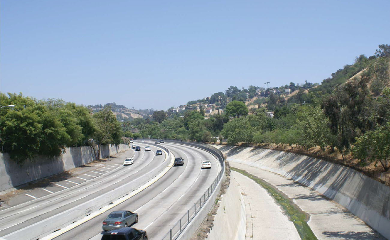
Fig. 3a. Looking Northeast from Pasadena Avenue. 2013. Hieu Nguyen. Note deepening and narrowing of the streambed.

Fig. 3b. Looking Northeast from Pasadena Avenue. 1955. Los Angeles Public Library. Note California sycamores lining the floodplain in the distance.
For another photo, I had to climb down the Arroyo Seco Channel to get the camera angle that I wanted. However, I was not satisfied with the angle and wanted to take it from the other side of the shallow running water way. So I tried to jump across, almost slipped and got myself all wet from knee down. But when I went home and overlaid the historical photo and the current photo, I realized that the current angle was incorrect because the channel bed today was much lower than the historical one due to the flood management and channelization of the Arroyo Seco (Fig 4a).

Fig. 4a. Looking Northeast from Avenue 26. 2013. Hieu Nguyen.

Fig. 4b. Looking Northeast from Avenue 26. n.d. Los Angeles Public Library Herald Examiner Collection.
One of my biggest disappointments was finding a lot of chain link fences on the bridges along the parkway. Because most of my camera shots were taken from the bridges, most of the photos were obstructed by the fences (Fig. 1a). Nonetheless, my professor, Dr. Susan Mulley, and classmates all agreed that the fences were significant landscape changes to the grand viewshed of the originally designed parkway and an important part of my research analysis.
Just as starkly, the historical photographs themselves show a channel that was anything but pristine. Creek Freak co-founder Jessica Hall notes that the Arroyo Seco was once characterized as a shallow and broad river. But even the earliest of the historical photos above already show levees and other substantial encroachments onto the Arroyo’s broad floodplain, which confine flow to a narrowed and deepened channel.
Such encroachments suggest that channelization did not happen in one fell swoop– attempts to control the flow of winter stormwater dated from the beginning of development in the Los Angeles basin and intensified with the changes in stormwater flow regime wrought by devegetation and proliferation of impermeable surfaces. The Army Corp’s famous post-1938 feats of flood control are merely the culmination of this history of efforts at confinement. The final result– a smooth and clean channel so conveniently free of vegetation or anything that might obstruct the swiftest flow of precipitation toward the sea. Gone is the disorderly seasonal dynamism of the original floodplain connecting the foothills to the coast. Channelization creates a streambed as neat as a conveniently placed pipe. One might imagine that streamflow originates from a magical tap in the foothills, rather than from the seeping of precipitation into the soil, and its slow under- and aboveground migration to the sea, which happens to leave in its wake a messy mosaic of vegetation and wildlife habitat.
Nguyen’s photographs also illustrate how armoring of banks with concrete did more than just alter hydrology and habitat. Channelization thoroughly severs any natural functional relationship between various parts of the larger watershed — literally paving the way to the radically featureless flat urban landscape we know today.

Love the historical photos. Thanks.
Great post and perspective. His last line say so much…
Growing up in the Torrance/Harbor Gateway area in the late 50’s – early 60’s, there were still a lot of creeks, ponds & sloughs to explore and capture the imagination. Now it’s a constant bed of asphalt, concrete, & rooftops. I’m glad I moved to rural Minnesota.
Yeah, Torrance is pretty much a total loss. I grew up there too late to see any of that stuff, just ditches. I moved to Vermont. Don’t miss Torrance a bit though I miss a few people who live there. I’d be happy if they all moved so I’d never have to set foot in that concrete hellhole again.
So how do I really feel? 🙂
Not sure it adds much to the visuals beyond being a herkyjerky riverbed perspective, but here’s a handlebar cam timelapse of a bike ride up the Arroyo Seco I did a couple years ago, from its confluence with the LA River up under Colorado Street Bridge:
[…] fence dividing the parks and Arroyo Seco was placed to control riverbed usage during flood season. However, so few gates were installed that there is hardly access when there is […]